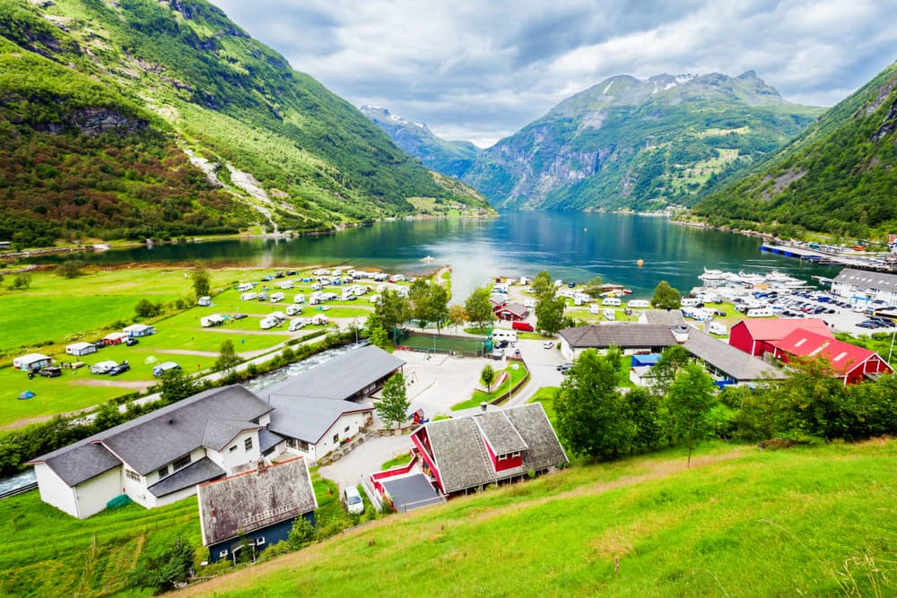
Geirangerfjord
Geirangerfjord
UNESCO-listed, Geirangerfjord unfolds 15 km of cliffs, waterfalls and viewpoints accessible from the village of Geiranger, on Norway's western coast.
Listed as a UNESCO World Heritage site, Geirangerfjord stretches for 15 km through the heart of Norway's fjord country. Sheer cliffs, suspended waterfalls and farms clinging to the slopes compose this arm of the sea dominated by snow-capped peaks. At its end, the village of Geiranger serves as a base for visitors.
Why visit Geirangerfjord
Geirangerfjord combines several assets that make it one of the most visited sites on the Norwegian west coast:
- UNESCO World Heritage status since 2005, shared with Nærøyfjord, which protects the landscape and limits the circulation of polluting vessels.
- Roadside and hiking viewpoints accessible at different levels of effort, from designated parking to high-altitude trails.
- A rare concentration of waterfalls hundreds of metres high, fed by snowmelt in spring.
- Maritime access via the Hellesylt–Geiranger ferry, which crosses the fjord along its entire length.
History and formation of the fjord
Geirangerfjord formed over more than 2.5 million years under the combined effect of tectonic movements and successive glaciations. Ice carved out ancient river valleys hundreds of metres below sea level, giving the fjord its characteristic U-shaped profile with near-vertical walls.
Human settlement dates back to the Viking era, with an economy based on fishing and agriculture. In the 19th century, sheep farming developed in the highland pastures above the fjord, on terraces accessible only by steep trails. The historic Skageflå farm, now restored and preserved, still testifies to this vertical agriculture today. The Trolls' Road (Trollstigen), opened in 1936, marked the opening of the region to modern tourism.
What to see at Geirangerfjord
Viewpoints
- Dalsnibba: platform situated at 1500 m altitude, offering a bird's-eye view of the fjord. Access is via a toll road, open from May to September depending on snow conditions. The Geiranger Skywalk platform at the summit features a glass floor and 360° panorama.
- Flydalsjuvet: free viewpoint accessible by car from the village, very popular but a must for framing the fjord from upstream.
- Ørnesvingen: located on road 63 between Geiranger and Eidsdal, this viewpoint overlooks the northern exit of the fjord and the Seven Sisters waterfall.
Waterfalls
- Seven Sisters waterfall (Sju Søstre): seven parallel cascades plunging over 250 m on the north shore of the fjord. Flow reaches its peak in spring, as snow melts.
- Storseterfossen: waterfall accessible by hiking trail from Geiranger, with a passage allowing you to walk behind the curtain of water.
Trolls' Road
Trollstigen links Åndalsnes to the Geirangerfjord valley via a succession of hairpin bends carved into the mountainside. The road is open only in summer season, generally from late May to October depending on conditions.
Activities on site
- Fjord cruise: the Hellesylt–Geiranger ferry crosses the fjord in approximately one hour and is the simplest option. Excursions in rigid inflatable boats (RIB) allow you to get closer to the waterfalls.
- Hiking: several trails depart from the village towards Skageflå, Storseterfossen or the heights of Flydalsjuvet. Allow 2 to 6 hours depending on the itineraries, with significant elevation gain.
- Sea kayaking: rental available at Geiranger, best enjoyed in calm weather.
- Cycling and mountain biking: marked routes on secondary roads in the valley bottom and around the village.
Practical information
Geiranger is a village of approximately 250 year-round inhabitants, whose visitor numbers surge in summer with the arrival of cruise ships. Accommodation options (hotels, campsites, cabins) are limited: booking several months in advance is recommended for high season. The majority of shops, restaurants and tour operators operate only from May to September.
When to visit
The ideal season runs from May to September. May and June offer the most powerful waterfalls thanks to snowmelt, but some high-altitude roads (Trollstigen, Dalsnibba) may still be closed early in the season. July and August see peak crowds and the best weather conditions. September marks a return to calm with the first autumn colours on the slopes. In winter, the village winds down and most viewpoints are inaccessible.
How to get there
- By train then bus: from Oslo, rail connection to Åndalsnes (approximately 5h30), then coach transfer to Geiranger in summer via Trollstigen. From Trondheim, allow half a day to Åndalsnes.
- By express coach: daily services departing Oslo, Trondheim or Bergen for Ålesund, with connections to Geiranger.
- By boat: car and passenger ferry between Hellesylt and Geiranger year-round (reduced in winter). In summer, the Hurtigruten runs up to Geiranger from Bergen; in winter, it stops at Ålesund with coach connections.
- By car: access from Ålesund (approximately 2 hours) or from Åndalsnes via Trollstigen in season.
To see in the surrounding area
Norway's fjord country offers many extensions from Geiranger. The Henjatunet farm, in Sognefjord, illustrates traditional Norwegian agriculture in comparable surroundings. Further west, the Bryggen district in Bergen and the Bergenhus fortress make complementary urban stops before or after the fjord. On the Oslo side, Akershus fortress and the city hall provide insight into the capital's historical heritage.
Frequently asked questions
Frequently asked questions
One day allows you to combine a cruise on the Hellesylt–Geiranger ferry and one or two viewpoints. To include a hike to Skageflå or Storseterfossen, allow two days on site.
The village remains inhabited, but most high-altitude roads, viewpoints and tour operators close from October to April. The ideal visiting season runs from May to September.
No, but a car makes it easier to access roadside viewpoints such as Dalsnibba or Ørnesvingen. Without a vehicle, cruises and hikes departing from the village remain accessible.
Both are listed together as UNESCO World Heritage sites. Geirangerfjord is wider, more accessible by car and concentrates the emblematic waterfalls. Nærøyfjord, to the south, is narrower and is discovered mainly by boat.
Planning your trip
Geirangerfjord fits naturally into a larger itinerary across the Norwegian west coast. To build an itinerary combining fjords, Bergen and capital cities, consult our Norway travel suggestions.
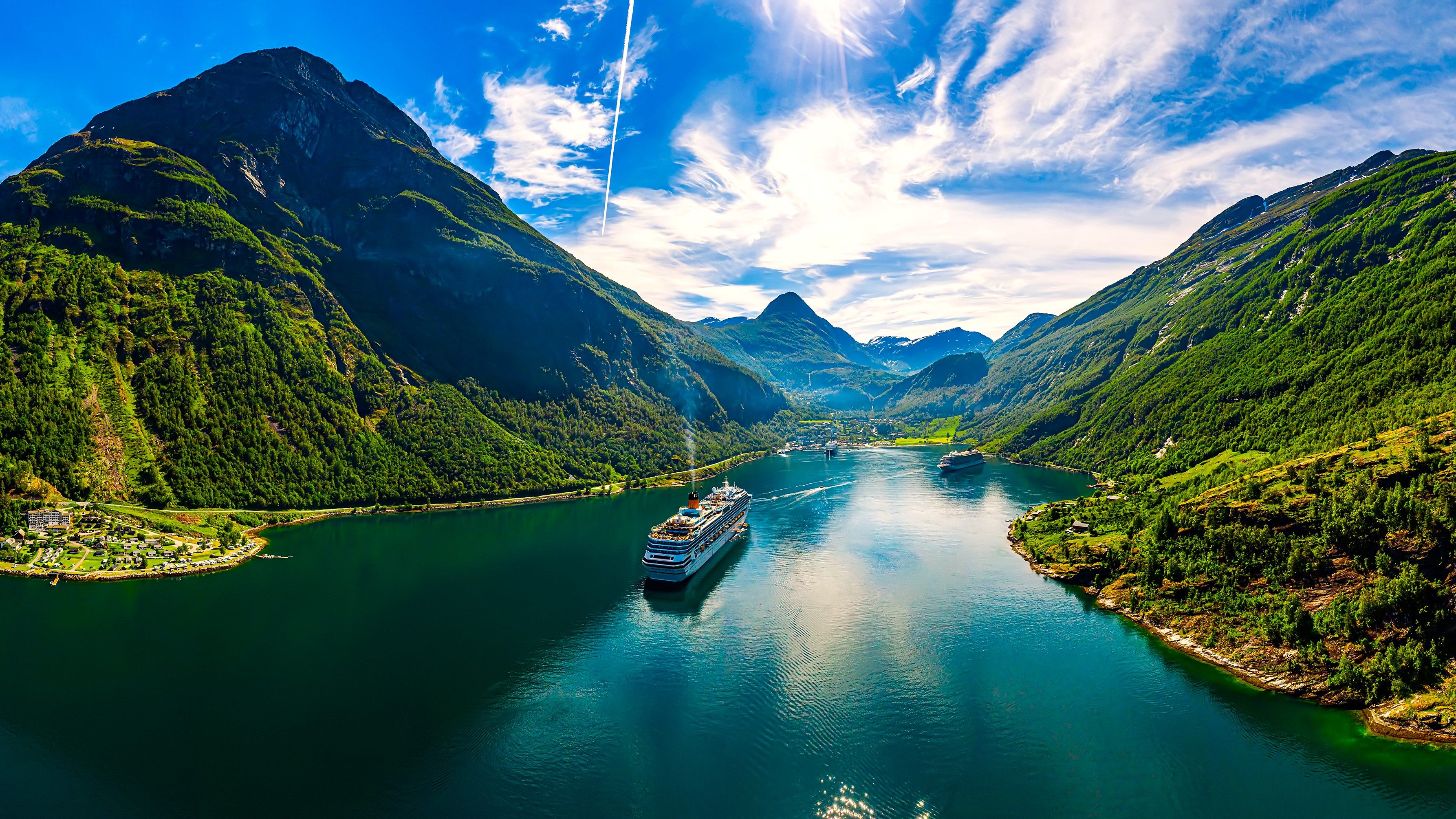
Interested in this visit?
We can include it in your personalised itinerary.